Full story
Joint Investigation Reveals Timeline of Mine Placement
The US-led United Nations Command (UNC) and South Korea’s Joint Chiefs of Staff (JCS) have concluded that North Korean forces deliberately placed antipersonnel mines south of the Military Demarcation Line (MDL) more than 12 months ago. The assessment follows a joint on-site investigation conducted by the South Korean military and the UNC from September 26 to 29.
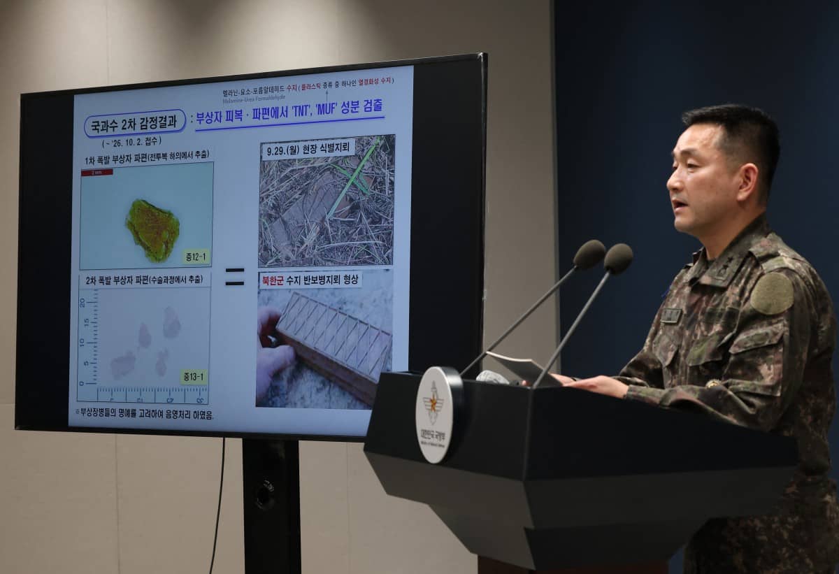
Yang Jin-hyeok, director of operations at South Korea’s Joint Chiefs of Staff, briefed reporters in Seoul on October 5, 2026, presenting images of landmines recovered from the blast site alongside previously recovered North Korean landmines. The investigation confirmed that the mines were planted well before they triggered an explosion on September 21 in the Demilitarized Zone (DMZ). That blast injured three South Korean military personnel.
Forensic analysis conducted by the National Forensic Service identified the devices as North Korean resin-cased antipersonnel mines. Investigators located at least four such mines planted approximately 10 meters south of the MDL. The South Korean military removed the minefield at 12:51 p.m. on Monday in coordination with the UNC.
A military official stated that this operation marked the first physical removal of a North Korean minefield found south of the MDL. Army Lt. Gen. Kwon Dae-won, vice chair of the JCS, confirmed that North Korean-made land mines caused the September 21 explosions.
Demands for Apology and Border Fortification Data
Following the confirmation of the mine placement, Kwon demanded an apology from North Korea. He urged Pyongyang to immediately remove mines installed in violation of the Armistice Agreement.
Brig. Gen. Kim Seong-yun, JCS director of intelligence analysis, provided additional data regarding North Korean military activities along the border. Kim reported that North Korea has deployed up to 7,000 personnel daily for border fortification work this year. According to Kim, minefields, fences, and tactical roads are approximately 40 to 60 percent complete, with overall work expected to finish within two years.
The investigation also highlighted increased cross-border activity by North Korean troops. Data indicates that North Korean troops crossed the MDL around 50 times this year. This figure represents a significant increase compared to the 17 cases recorded in 2025 and the nine instances documented in 2024.
Concentrated Activity in the Eastern Sector
A substantial portion of these incursions occurred at a single location. More than 40 of the crossings took place in the eastern sector, utilizing a patrol route that extends approximately 10 meters south of the MDL. This concentrated movement aligns with the locations where the mines were subsequently discovered.
Discrepancies in Border Markings and Historical Context
The precision of these border violations is complicated by differing cartographic standards between the two sides. South Korea utilizes an MDL marked on maps established by the US National Geospatial-Intelligence Agency in 2004. In contrast, the UNC relies on coordinates derived from its own 2016 project. These two lines do not fully coincide, creating potential ambiguities in boundary enforcement.
The physical markers intended to delineate this border have also suffered significant degradation over time. Of the 1,292 markers originally installed following the 1953 Armistice Agreement, only about 200 remain today. The loss of these physical demarcations underscores the challenges in maintaining clear boundaries without relying on digital coordinates or active patrols.