


Official Standardization of Geographical Names
The Government of India has formally standardized the names of 27 locations and geographical features across Arunachal Pradesh on official Survey of India maps. The standardization process followed consultations between the Central Government and the Arunachal Pradesh state government, resulting in a definitive list of place names to be used in official cartographic records.
The official list published by the government includes 21 land locations and four mountain passes. In addition to these terrestrial features, the standardization covers Sambho Sarovar, identified as a lake, and the Sher-e-Thapa Memorial. The inclusion of these specific sites marks a formal administrative step in defining the geographical nomenclature of the region.
According to reports from Asia News Network, citing The Statesman, this action was taken to establish clear and uniform naming conventions for the area. The information regarding the standardization and the composition of the list was derived from these sources. The report notes that the official list covers the 21 land locations, four mountain passes, Sambho Sarovar, and the Sher-e-Thapa Memorial.
Strategic Context and Border Dynamics
The standardization of these place names is described as a countermeasure to China’s "map war" regarding the region. The move by New Delhi is positioned within the broader context of territorial disputes between India and China, particularly in the eastern sector where both nations claim sovereignty over overlapping territories.
India administers Arunachal Pradesh as a state, while China refers to the area as South Tibet and claims it as part of its territory. The publication of standardized names on official maps is viewed by analysts and sources as a diplomatic and administrative tool to reinforce India’s territorial integrity against Chinese assertions.
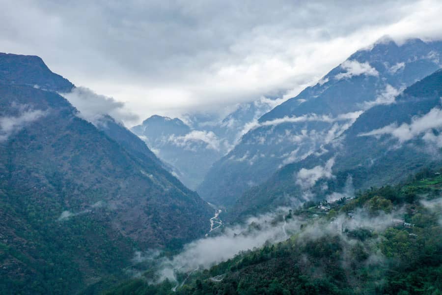
Visual documentation of the region highlights the strategic importance of the area. A photograph taken on April 4, 2023, shows a valley near the Indo-Chinese border in the Tawang district of India's Arunachal Pradesh state. This image, credited to AFP, illustrates the terrain where such geographical standardizations are relevant.
Regional Implications
The designation of specific names for mountains passes and land locations serves to cement administrative control in remote border areas. By officially recognizing features such as Sambho Sarovar and the Sher-e-Thapa Memorial, the government integrates these sites into the national geographic framework.
The consultation process between the Centre and the Arunachal Pradesh government indicates a coordinated effort at both the federal and state levels to address geographical naming conventions. This alignment ensures that all official documents and maps reflect the standardized list uniformly.
Historical and Administrative Significance
The establishment of these standard names addresses long-standing issues regarding the nomenclature of border regions. Prior to this standardization, variations in naming may have existed across different maps or local usages. The new official list provides a single authoritative reference for all government operations in Arunachal Pradesh.
The inclusion of the Sher-e-Thapa Memorial in the standardized list highlights the cultural and historical dimensions of the geographical features. Similarly, the identification of Sambho Sarovar underscores the importance of natural landmarks in the regional identity.
As reported by Asia News Network on August 13, 2026, the formal identification of these 27 locations represents a significant administrative update. The report emphasizes that the names are now fixed on Survey of India maps, removing ambiguity for official and legal purposes.
International Observations
The move has been characterized as part of India’s broader strategy to manage its border disputes with China. By standardizing place names, New Delhi aims to strengthen its legal and historical claims to the territory in international forums and domestic policy.
The timing of the announcement, reported on August 11, 2026, follows previous diplomatic tensions and military standoffs along the Line of Actual Control. The standardization serves as a non-military but firm assertion of administrative jurisdiction over the area.
Observers note that such cartographic actions are common in territorial disputes, where control over maps often parallels control on the ground. The Indian government’s decision to publish a comprehensive list of 27 standardized names reflects a proactive approach to managing its eastern border region.
Local Impact
The standardization affects local administration, education, and infrastructure planning in Arunachal Pradesh. All government records, including land deeds, educational materials, and development projects, will now utilize the officially recognized names for the 21 land locations, four mountain passes, Sambho Sarovar, and the Sher-e-Thapa Memorial.
This uniformity is intended to facilitate clearer communication and governance in the region. It also aligns local administrative practices with national standards, ensuring consistency across different levels of government.