


Cartographic Shift Prompts Global Discussion
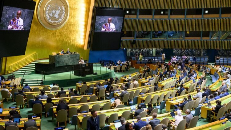
The United Nations General Assembly has issued a directive to promote the use of world maps that more accurately represent the relative sizes of continents. This administrative decision has immediately triggered a broader debate concerning how Africa is represented on the global stage and how such cartographic choices influence international perception.
According to reports, the move by the UN body marks a significant development in a long-standing discussion regarding cartography, representation, and the mechanisms through which people perceive the world. The decision has opened what sources describe as "a new chapter" in these ongoing dialogues about how geographic data is visualized and disseminated globally.
The core of the controversy lies in the historical accuracy of standard map projections. Traditional maps, particularly those utilizing the Mercator projection, have been criticized for distorting the size of landmasses relative to one another. In these standard depictions, regions closer to the equator often appear smaller than they actually are compared to lands further north or south. Africa, which spans a vast area across the equator, is frequently depicted as significantly smaller than its actual landmass in conventional educational and commercial maps.
By advocating for maps that correct these proportional inaccuracies, the UN General Assembly is addressing what many cartographers and geographers argue has been a systemic bias in global visual data. The new guidance encourages the adoption of projections that maintain accurate area ratios, thereby presenting Africa as the large continent it is geographically, rather than the diminished shape often seen in older or standard commercial atlases.
Implications for Global Perception and Representation
The debate sparked by this vote extends beyond technical cartography into the realm of political and social representation. Critics of traditional mapping techniques have long argued that the visual diminishment of Africa contributes to a broader marginalization of the continent in global discourse. By altering the visual scale, the UN's stance aims to correct what is perceived as an unequal representation in how the world views African geography.
Proponents of the new map standards suggest that accurate representation is crucial for fostering a more equitable understanding of global resources, population density, and geopolitical weight. When a continent is visually minimized, it can inadvertently influence public perception regarding its importance in international affairs, trade, and cultural exchange. The UN's promotion of these accurate maps is seen by supporters as a step toward rectifying historical imbalances in how the continent is portrayed to the world.
However, the implementation of such changes has raised questions among educators, publishers, and digital platform operators regarding the scope of adoption. While the General Assembly has promoted these standards, the extent to which they will be mandated or merely encouraged across different UN agencies and member states remains a point of discussion. The decision serves as a catalyst for institutions worldwide to review their own cartographic materials.
Historical Context of Map Projections
The roots of this debate trace back to the 16th century, when German cartographer Gerardus Mercator developed his projection for navigation. While effective for maritime routes, the projection stretches landmasses at higher latitudes, making Europe and North America appear larger relative to Africa and South America. This distortion has persisted in common usage for centuries, embedding a specific visual hierarchy into global education and media.
Various alternative projections have been developed over the years to address these distortions, including the Gall-Peters projection and the AuthaGraph. The UN's current focus on promoting maps that "more accurately represent the relative size of continents" aligns with the principles behind these alternative models, which prioritize area accuracy over shape or distance preservation.
The recent vote has brought these technical alternatives into the spotlight of international policy. It highlights a growing recognition among global bodies that the tools used to visualize the world carry inherent political and social implications. The debate is no longer just about mathematical precision but about how those precise visuals impact the narrative of global development and identity.
Responses from Cartographic Experts
Experts in geography and cartography have weighed in on the significance of the UN's decision. Many argue that the visual accuracy provided by these new standards is essential for correcting misconceptions held by the general public. For instance, a map that shows Africa as roughly 14 times larger than Greenland—a fact often obscured by traditional maps—provides a more truthful baseline for discussions on climate, biodiversity, and human geography.
The debate also touches upon the standardization of educational materials. Schools and universities around the world rely on consistent mapping standards. The UN's promotion of these accurate representations may lead to a gradual shift in textbooks and digital resources, ensuring that future generations are taught a more geographically accurate view of the planet.
As the discussion continues, the focus remains on the practical application of these new guidelines. While the General Assembly has set the direction, the actual transformation of global maps depends on the cooperation of various stakeholders, including governments, educational institutions, and private publishers. The vote serves as a formal acknowledgment that representation matters, and that the way Africa is depicted on the world stage is inextricably linked to how it is perceived by the international community.