


Disparity in Disaster Reporting
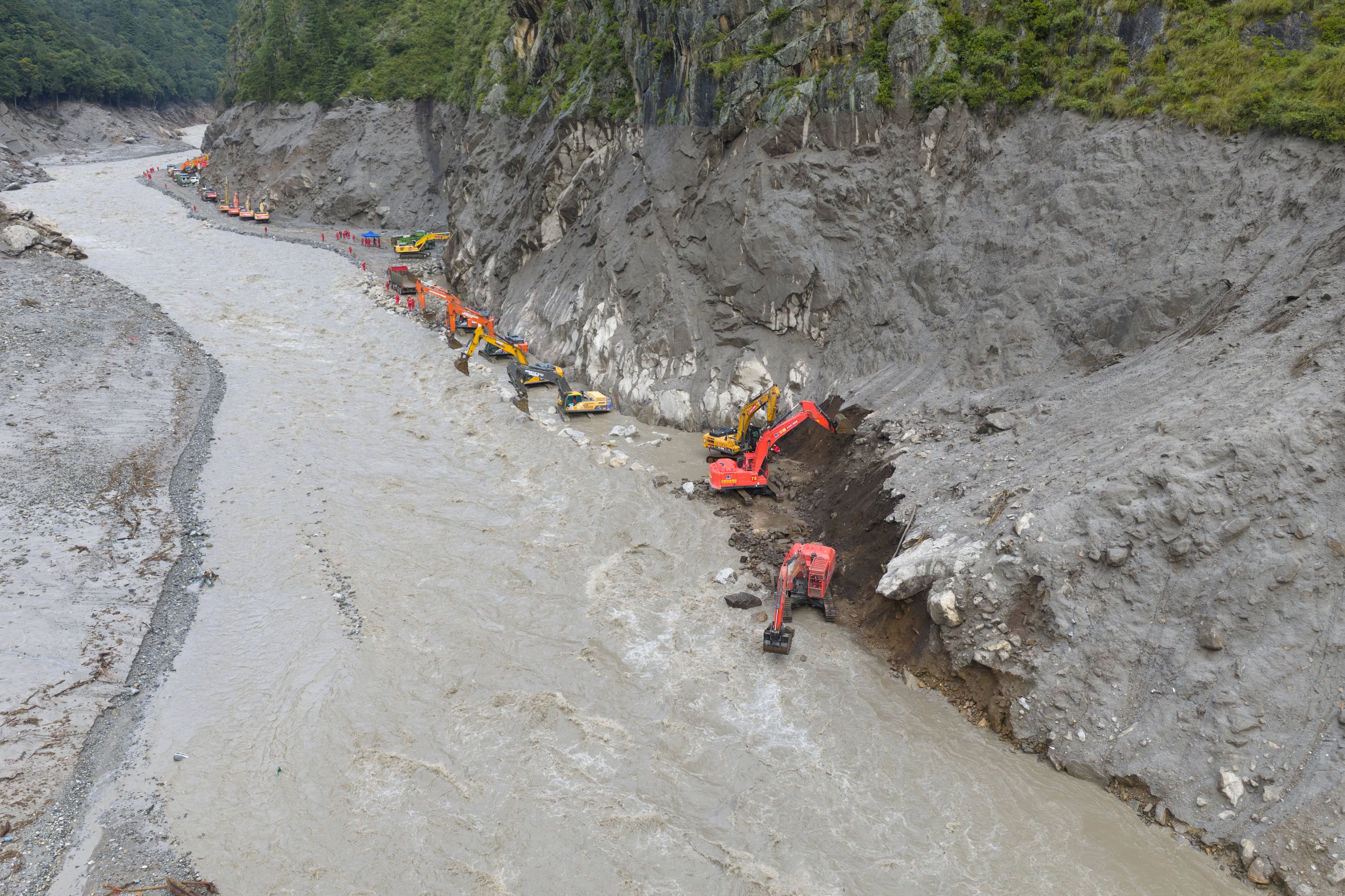
On August 26, a glacier detached above the Nepal-Tibet border, sending a mass of ice, rock, and water cascading down the Bhote Koshi valley. The resulting disaster caused significant loss of life and widespread devastation on both sides of the border, but the reported figures from Beijing and Kathmandu reveal a stark contrast in the human toll.
Nepal counted over 1,300 people dead and thousands more still missing as a direct result of the catastrophic event. The scale of the tragedy overwhelmed local communities and rescue efforts. In stark contrast, China, which governs the villages on the other side of the same disaster zone within the Tibetan Autonomous Region, reported only a handful of casualties. This significant disparity in casualty numbers is not merely a statistical anomaly but serves as a focal point for understanding the broader dynamics of the region.
Information Control Amidst Crisis
The gap in reported figures illustrates how infrastructure development and strict information control in Tibet operate in tandem. Beijing consistently presents its extensive activities in the Tibetan Autonomous Region internationally as part of a progressive "green development" initiative. However, the handling of the disaster data, particularly the minimization of casualties on the Chinese side, suggests a deliberate strategy of rapid infrastructure construction coupled with stringent information management and censorship.
This approach raises questions about transparency and the true impact of environmental events in a region undergoing rapid transformation. The ability to control the narrative, even in the face of a major natural disaster, underscores the strategic importance China places on managing perceptions both domestically and internationally regarding its presence and activities in Tibet.
Strategic Infrastructure: Green Facade, Dual Purpose
China markets the Tibetan Autonomous Region as a world-class clean-energy frontier, promoting an image of sustainable progress. This narrative includes the construction of massive hydropower dams on the Yarlung Tsangpo River, the development of vast solar farms spreading across areas like Shigatse and Gar County, and the establishment of ultra-high-voltage lines designed to transport power eastward across the country. Institutions like India's Takshashila Institution have meticulously tracked this expansion, noting significant capacity additions in renewable energy since 2013.
Tibet's Renewable Energy Push
The Takshashila Institution's research has recorded sharp jumps in renewable energy capacity within the Tibetan Autonomous Region. This includes an addition of 700 megawatts in 2023, followed by 860 megawatts in 2024, with an estimated 2,600 megawatts projected to come online in 2025. These figures highlight a concerted and aggressive push to expand renewable energy infrastructure, aligning with China's broader goals for energy security and its international messaging on climate action.
Geospatial Clues to Military Applications
However, detailed geospatial mapping data complicates the purely environmental narrative put forth by Beijing. The same mapping efforts that recorded this impressive growth in renewable energy capacity also identified solar sites situated in close proximity to existing airport infrastructure. Furthermore, these sites were located within three kilometers of an antenna array specifically associated with signals monitoring activities in Gar County. These proximity findings strongly suggest that the infrastructure serves purposes beyond purely climate initiatives, indicating potential dual-use applications for both civilian energy and strategic military or intelligence operations.
The "Gray-Zone" Strategy Unveiled
A Washington-based study by the Center for Strategic and International Studies (CSIS) describes this pattern of development as a "gray-zone infrastructure strategy." According to the study, this sophisticated approach utilizes a comprehensive network of dams, roads, rail lines, and digital systems to build coercive leverage over neighboring countries, particularly India and Nepal. The CSIS analysis emphasizes that this leverage is established without a single shot being fired, relying instead on the physical presence and integrated functionality of this extensive infrastructure. This strategy allows China to exert influence and control in the region through non-military means, creating facts on the ground that alter the geopolitical landscape.
Electrified Outposts: Bolstering Border Presence
The energy grid in the Tibetan Autonomous Region does not function in isolation as a mere power source for civilian populations. Instead, it feeds a meticulously planned network of electrified border villages, microgrids, and military garrisons that has expanded steadily since 2017. This integrated system is crucial for China's strategic objectives in the sensitive Himalayan border areas.
Expanding Civilian and Military Footprint
These fortified settlements and their robust power supply allow China to maintain a permanent civilian and military footprint directly opposite India's strategically vital Arunachal Pradesh, Sikkim, and Ladakh sectors. The continuous expansion of these outposts, supported by reliable energy, ensures a persistent presence that can be rapidly scaled up or utilized for various strategic purposes. This network effectively transforms remote border regions into integrated zones of control, bolstering China's territorial claims and enhancing its operational capabilities along the disputed frontier.
Dependence on Dual-Use Power Grids
The very existence and operational reliability of these border settlements, whether civilian communities or military garrisons, depend entirely on the power infrastructure that China promotes abroad as a climate initiative. This intrinsic link between energy production and strategic positioning underscores the profound dual-use nature of the developments in the Tibetan Autonomous Region. What is presented as a commitment to clean energy also serves as a critical enabler for China's long-term geopolitical and military objectives in the Himalayas, creating a complex web of environmental claims and strategic realities.